I updated (29th Sept 2013) with a few more apps I came across.
Sorry no windows phone apps because I am not on windows phone :p
Scroll right down for non-train related app.
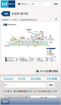
Tokyo Metro Subway (free) (iphone)
This app is limited to subways (metro, toei) only. So JR densha and private (above ground type) lines are not included. The only(?) good thing is it's in English so you can find your route using romaji.
It tells you the estimate journey time but doesn't seem to list out alternative routes (if any) or the time. Only "Fastest Route" and "Fewest Changes".
It also gives you nearby stations according to your location, with a choice of train map and normal map (probably mapped over Apple's map).
Personally I won't use it coz it's limited to subways and doesn't tell you the timings. But it's the only decent English train app I've found for Tokyo.
Tokyo Rail Map+ Lite (free) (iphone)
There is another Tokyo Rail Map Lite (without the + sign) which has been discontinued. I tried both and this has got one extra function which is searching for route. Very nice free app that has blinking animation showing you the stations passing through as it brings you from your starting station to your ending station. Only one possible route shown though.
Good feature? It covers all(?) the lines in Tokyo. Subways, JRs, private. Bad thing? I found some missing stations in the monorail line (ok, maybe only this line that is incomplete). You can search stations by names (Japanese, English both ok), or through the lines they are on. Really not bad for a free app!

Manta (free) (iphone) (android)
An experimental app by Tokyo Metro scheduled to last until 2014 Jan, you have to be able to read Japanese to use this. Not a route app but it allows you to connect to the free station wifi when you create an account (English sign in page available).
Other features include railroad information system like timetables (good for last trains), exits, station maps (good when planning for meetups). One interesting feature is the train alarm that beeps you when you reach your station. Must set the timing yourself to match the boarding/alighting time though. Even works with JR and private lines (the website says). Haven't used before so I can't comment but I've seen people using it so it must be okay?
Timetables, exits and station map
Toei Navi (free) (iphone)(android)
The same as Manta, except this is the Toei subway version, with bus routes included. Personally I think this app is… shit. You can download and how bad it is. The only reason why i found it was because one day i tried the "Near Me" feature in the new iOS App Store. It said "popular near me" mah, so I downloaded it. Utterly horrible. The creator should be banished into the 18th level of hell.
Now the following, I've used them before and some of them I'm still using.
Japan Subway Route Map (Tokyo Osaka Nagoya) (paid) (iphone)
This app does not allow you to search for routes. But I like it coz sometimes i need to check what stations do the lines have. I want to be able to see the lines individually and not as a big mess of glomerulus. Plus the design is neat and very easy on the eye. So I tend to rely on it more.
It has english and also lists out all the intersecting lines/interchanges beside the stations of the line you're checking out. It even tells you which stations are skipped for those with express services passing through so you know whether you would miss your stop if you accidentally stepped into one.
It also has a very good compilation of the exits of each station with the nearby landmarks/roads included. Helps when you need to plan with friends and have to find out which gentry you should go out to meet at. Recommended if you're willing to pay.
Apparently you can also set the region to Tokyo, Osaka or Nagoya but it doesn't work for me now on iOS7.

Tokyo × Kanagawa Route Map (paid) (iphone)
It seems there are a few versions of this app. Now on 50% off. And this.
This is like the above app, showing you the different lines individually, but this one includes JR and private lines and lines to god knows where. Available in English too. I don't quite like the drawings (compared to the above) but it is still functionally good enough. Plus, the general train map has an option that lets you select whether to highlight the subways or the JRs. That makes it easier to see through the gigantic mess of lines. Recommended if you are exploring slightly further outside of central Tokyo and willing to pay for an all-in-one map.
Tokyo Metro Map (free) (iphone)
This is the simplest, no fuss app. A digital edition of the piece of train map flyer that one gets from a station. But why is this called Tokyo Metro Map when it's actually filled with JR lines??? Good for rainy days when your paper map becomes soggy kimchi.
Yamanote-line Exit (free) (iphone)
This is also a very simple app, featuring just the yamanote circle line that every visitor most certainly will ride on at least once during his stay in Tokyo.
It's just a circle of stations. You tap on your boarding station and the estimate time needed to reach the next station for alighting will show. Tap on the alighting station and you will see the different exits, which number cars the exits are located near to and the transfer services available. I use this app when I want a quick reference of the direction (clockwise, anticlockwise) I want to go by, with respect to my destination. I so hate to absentmindedly take the "long end" of the circle >_<;;

Tetsuchizu 2011 (paid) (iphone)
This is like the mother of all train maps. It covers the whole of Japan. But methinks it's not very user friendly. Only for train otakus. Not very useful when you just want to search for "short" distance within the city.
Navitime (free) (iphone) (android)
Transfer Navitime (free) (iphone) (android)
These two apps are very similar. Actually i would think they are the same… Both are good. But you do need to know how to read Japanese. Or at least know how to read chinese characters to get around it.
The app allows you to set your map to Tokyo (metropolitan area), Tokyo (subway), Kansai region or Nagoya. Very useful like 3-in-1 map.
With portable wifi dongle+sim card so easily available nowadays, having internet connection is not a problem desho? So you can just tap on the nearest station name at your location to set your departing station and scroll through the map to find your next station and set it as your destination. No need to type anything. Hit search and a list of probable routes will appear with the timings, time needed, transfers (if any), prices nicely presented before you. Tap on the desired route and it will tell you the name of the line(s), the platforms you are to wait at. It also gives you the last train timing so you can party/shop/eat till late.
Definitely one of the best apps around to use. I use this a lot! If you have to get just one app, this is the one. ☆☆☆☆☆ 5 stars for it. Better than the ekitan or the Yahoo one, imo.
Tokyo Musen (free) (iphone) (android)
Lastly, if you needed to rush to some place urgently, like OVERSLEPT MUST GO TO THE AIRPORT NOW OMG!! You can get a cab with this! It knows your current location and you can just zoom in on the map for your destination to tap it. Kantan desho? It can even give you an estimate of the cab fee which is like wow. (other extra charges, like night surcharge (10pm-5am), highway toll fee, 300 yen hailing service via the app are added separately)
I guess that's all for this blog post~ Hope they have been useful!
No comments:
Post a Comment